Oxford Street West Environmental Assessment
Image
Image
The official website for the City of London, Ontario
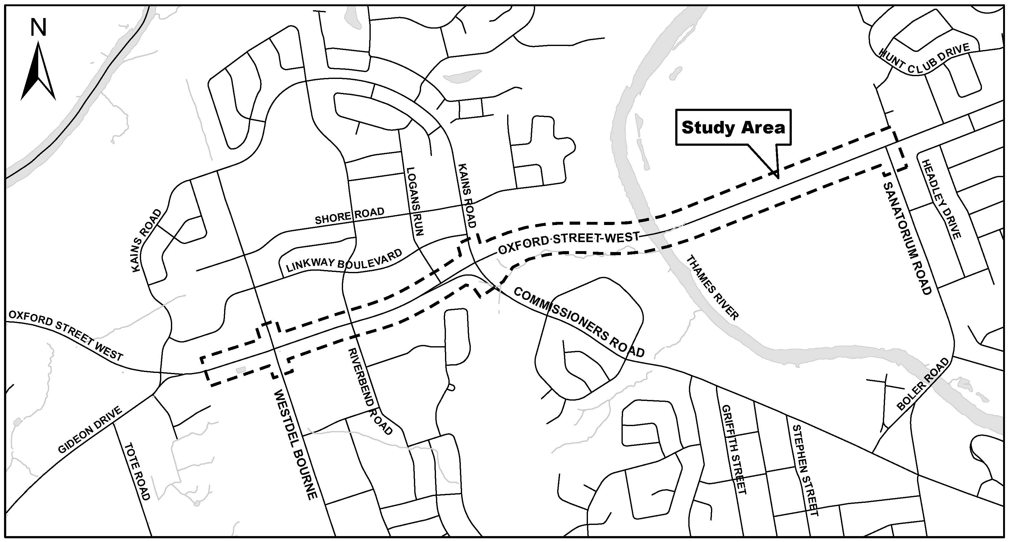
The City of London has initiated a Municipal Class Environmental Assessment (Class EA) study for improvements to Oxford Street West, from Westdel Bourne to Sanatorium Road.
This study builds on the City’s 2030 Transportation Master Plan and Cycling Master Plan to develop and review options to widen Oxford Street West from two to four lanes, improve intersection operations including consideration of roundabouts, and improve pedestrian and cycling facilities through the corridor. The potential need to widen the Thames River Bridge will also be reviewed.
The study began in December 2022. The first Public Information Centre took place in April 2023, and the second meeting in December 2023. These public meetings were an opportunity for residents to learn about the study, to ask questions, and share comments with the project team.
The PIC display materials and a recording of the presentations is available on the project's Get Involved webpage.
The Draft Environmental Study Report has been posted to the project's Get Involved webpage under the 'Documents and notices' section. The 30-day public review period will begin after Council approval of the Environmental Assessment.
The City sent out a notice of commencement to residents, business owners and interested stakeholders to notify them of the Environmental Assessment's start.
The first Public Information Centre took place in April 2023.
A second Public Information Centre took place on December 6, 2023.